
 Garbage & Recycling Collection
 Trees
Trees Water & Sewer
 Landscape Waste/Composting
 Senior Services
 About Glenview
 Street & Sidewalk Maintenance
 Building Permits
 Commuter Parking
 Block Party, Special Event & Film Permits
 Doing Business in Glenview
 Business License
 Construction Projects
 Development Projects
 Contractor License
 Code Enforcement and Property Maintenance
 Sustainability & Natural Resources
 Stormwater, Floodplain and Engineering Resources
 Master Plans & Studies
 Board of Trustees
 Meeting Agendas, Minutes & Video
 Boards and Commissions
 Budget
 Voter & Election Information
 Purchasing
 Municipal Code
 Glenview Governance
 Freedom of Information Act
 Transparency
 Communications
 Community Development
 9-1-1 Dispatch
 Finance
 Fire Department
 Human Resources
 Management Services
 Police Department
 Public Works
_4_760.jpg)

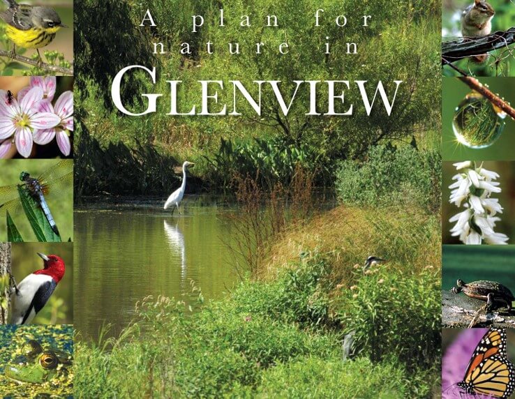
Plan for Nature
The Village first adopted A Plan for Nature in Glenview in 2008, a two-volume report inventorying and detailing the ecological condition and potential of 99 open space areas of one acre or larger in the Village of Glenview.
The goal of Glenview’s Plan for Nature was straightforward: To enhance, improve and protect the natural areas and open spaces of Glenview, including prairie, wetlands, rivers and streams, shorelines and detention basins. These resources enrich our quality of life, and the Village, its residents and local businesses can all play a part in contributing to their preservation.
In 2022, the Village engaged with a consultant to update its Plan for Nature, including a re-evaluation of all the sites included in the original plan in addition to new sites throughout town. The updated Plan identified more than 20 additional sites with potential for improved habitat. The updated plan may be viewed below.
2023 Plan for Nature
The updated Plan for Nature was adopted by the Village Board on March 19, 2024. The plan began with a technical natural resources assessment, which identified 120 open spaces, both publicly and privately owned, for their potential to contribute and support natural habitat.
The Plan provided recommendations to improve natural habitat within the Village regardless of ownership or current condition of the open space parcels. It also offered a system to prioritize projects according to feasibility and impact. The Village will utilize this updated plan in an effort to expand the list of accomplishments made since the 2008 Plan for Nature was implemented.
Numerous successful habitat and water quality improvement projects have resulted from the implementation of the recommendations included in the 2008 planning document. Examples include re-meandering and naturalizing the streambanks of West Fork Chicago River for 3,000 feet along the Techny Basin; retrofitting several Village-owned stormwater detention basins to support native vegetation rather than turf grass; installing rain gardens; and creating a downtown river walk with naturalized streambanks.
Other opportunities in the Plan became unavailable over time, and new opportunities have arisen, necessitating the latest update in 2023.
- A Plan For Nature in Glenview Technical Report: Main Report
- A Plan For Nature in Glenview Summary Report
- Existing Ecological Conditions and Recommendations Tables (extracted from full report)
- Appendix A: Descriptions and Recommendations on High Priority Sites
Of 120 natural areas and resources in Glenview, the value of 37 sites, totaling 2,226.53 acres, was set as high by the Environment and Natural Resources Commission. To read more, see the full Plan for Nature linked above.
Robyn Flakne, the Village's Natural Resources Manager, wrote about Glenview's Plan for Nature in this March 2012 article published in Environmental Practice:
West Fork of the North Branch of the Chicago River
The Village has done much to improve the water quality of this fork of the Chicago River that cuts through Glenview, as detailed in the following information sheets.
NATURALIZED STORMWATER DETENTION
PERMEABLE PAVEMENT AND GREEN ROOFS
REACH 1 RE-MEANDERING AND NATURALIZATION
STABILIZATION
- Longvalley Streambank Stabilization Information Sheet
- Lot 16
- Pine Street Streambank Stabilization
- Reach 1 Streambank Stabilization
- West Fork Green
- West Fork Riverwalk
Read the report:
West Fork Corridor Map
The West Fork Corridor is a large contiguous natural area surrounds the West Fork of the Chicago River's North Branch. Its most prominent feature is the Techny Basin, which stores storm water overflow from the river during heavy rain. Downstream along the West Fork, the Village has stabilized the stream bank and added native landscaping to create natural spaces at the Pine Street floodplain parcel, Downtown Glenview (north and south of Glenview Road at the river), and the Longvalley floodplain parcel. Together with parks and other open spaces adjacent to the river, these areas create a corridor of natural habitat. To see a map of Village-owned West Fork Corridor locations, visit the West For Corridor Map

What can we help you with today?
-
Administrative Adjudication

Administrative Adjudication
The Administrative Hearing process is independent from the Village departments that investigate, initiate and prosecute the Code violations. It hears cases involving Building Code violations, Fire Code violations, unlicensed businesses, health and sanitation, parking, inappropriate conduct and some animal related citations and other ordinance matters involving the quality of life in the Village of Glenview.
-
Amtrak-Hiawatha Proposal

Amtrak-Hiawatha Proposal
Between 2014-19, the Village, with strong support from the community, vigorously opposed an effort to install a holding track in Glenview. A holding track serves to park freight traffic to allow the passage of passenger railcars. The Illinois Department of Transportation, along with state and local officials, ultimately agreed with the Village, determining a holding track was not a viable solution with significant environmental, health and public safety impacts.
-
Bicycle Registration

Bicycle Registration
Bicycle registration is free. Having your bike registered increases the chance of it being returned if it is lost or stolen.
-
Bike & Pedestrian Master Plan

Bike & Pedestrian Master Plan
The Village has completed the final drafts of the Bicycle and Pedestrian Plan and the ADA Transition Plan. These were adopted by the Village Board of Trustees at its meeting on Nov. 7, 2023.
-
Block Party Permit

Block Party Permit
The Village of Glenview allows block parties on all residential streets, but they must not block intersections, culs-de-sac or other roadways. To schedule a block party, obtain a block party permit and return to the Village Manager's Office at 2500 East Lake Avenue or by e-mail to Lisa Goodwin at lisag@glenview.il.us. There is no fee for a permit.
-
Block Party, Special Event & Film Permits

Block Party, Special Event & Film Permits
To ensure block parties and special events held in the community are safe, the Village may require event organizers to obtain a permit. Explore information about various permit requirements.
-
Board of Police and Fire Commissioners

Board of Police and Fire Commissioners
The Board of Fire and Police Commissioners is tasked with establishing the testing and hiring process for employment within the Village’s Fire and Police Departments. In addition, the Board has the authority to suspend, discharge, demote, cause longevity or holiday pay to be forfeited, and order random drug testing of any officer or sworn member of the Fire or Police Department.
-
Board of Trustees

Board of Trustees
The Village of Glenview Board of Trustees has the power to enact laws and policies, consistent with state law, regulating local and municipal affairs, usually through the enactment of ordinances and resolutions.
-
Board of Trustees Meeting Reports

Board of Trustees Meeting Reports
Village Board of Trustees meeting minutes are available back to 1915 and agendas date back to 1989. A full archive of agendas and minutes is available online.
-
Buckthorn Removal Incentive Program

Buckthorn Removal Incentive Program
Are you considering removing buckthorn from your property? The Village of Glenview can help! The Buckthorn Removal Incentive Program provides a 50 percent reimbursement - up to $600 - for preapproved buckthorn removal projects.
Related Services
-
Business License

Business License
Per the Glenview Municipal Code, business licenses are required for all businesses that have locations within the corporate limits of the Village of Glenview.
An initial business license is required upon establishment, change of location, or change of ownership, and must be obtained before opening or relocating in Glenview.
Related Services
-
Code Enforcement & Property Maintenance

Code Enforcement & Property Maintenance
All communities need building codes to protect citizens from disasters like fires, weather-related events and structural collapse. To protect the health, safety and welfare of residents and businesses, the Village of Glenview sets forth maintenance standards for all properties within Village boundaries.
Related Services
-
Commercial Inspections

Commercial Inspections
Every permit issued by the Village of Glenview requires an inspection. Please call (847) 904-4320 to schedule all commercial inspections.
Related Services
-
Commercial Remodeling & Alterations

Commercial Remodeling & Alterations
A commercial remodeling permit is required for interior remodeling by existing businesses. These include projects such as interior build-out, remodeling of existing commercial space and alteration of interior electrical, plumbing, fire and mechanical systems.
-
Commission Volunteer Application

Commission Volunteer Application
Interested in serving on a Village commission? Click here to learn more about opportunities to serve the community and Make Life Better in Glenview.
-
Community Services

Community Services
There are countless services and programs available to the community apart from those provided by the Village of Glenview. Explore healthcare services, community partners, service clubs and area government offices.
-
Community Solar

Community Solar
Community solar allows “subscribers” to receive net metering credits on their electricity bill and support the development of new renewable energy resources without needing to install equipment on their property. A community solar project is a single site solar installation shared by multiple subscribers. Community solar projects in Illinois are defined as no larger than 2,000 kW in peak capacity per site.
Related Services
-
Commuter Parking

Commuter Parking
There are two train stations in the Village of Glenview, and both stations offer adjacent commuter parking. Learn more about parking options and pricing.
-
Comprehensive Plan

Comprehensive Plan
In 2015, the Village Board of Trustees appointed a committee of residents to update the Comprehensive Plan, which acts as a roadmap for development to manage change and help prioritize resources.
Over the course of numerous public meetings in 2016 and 2017, the Committee, Village staff, and a consultant set about drafting a Plan. The document was adopted by the Board of Trustees on February 21, 2017.
-
Construction Projects

Construction Projects
The Village's Capital Improvement Program (CIP) reflects a strong commitment to maintain high-quality infrastructure for the benefit of residents and businesses in Glenview. Active and forthcoming construction projects can be found here.
-
Contact Us
-
Contractor License

Contractor License
Certain contractors are required to register with the Village of Glenview or provide a copy of their license before beginning work within the corporate limits of the Village. Contractors may submit their registration online or via printed submission. A change of contractors form must also be filed with the Village if a work permit has already been issued for a project.
Related Services
-
Cross Connection Control

Cross Connection Control
A cross connection is any real or potential connection between the water supply and a source that can contaminate or pollute that water.
When the system experiences a loss in water pressure, such as when a fire hydrant is opened or a water main breaks, a backflow can occur that causes water in the pipes to flow in the opposite direction. That's when a contaminant or pollutant could travel into drinking water.
-
Development Center

Development Center
The Development Center is the first point of customer contact for all Community Development-related services, located just inside Village Hall. The Development Center staff will respond to walk-in, email and phone inquiries related to planning, engineering, building permits, inspections, capital project improvements and complaints.
-
Doing Business in Glenview

Doing Business in Glenview
The Village of Glenview is dedicated to developing and maintaining excellent relationships with new and existing businesses within the community. Businesses that choose to locate in Glenview are offered a wide array of incentives, have access to a talented and highly educated workforce, and maintain proximity to the City of Chicago, local expressways, commuter trains and regional and international airports.
Ready to call Glenview home to your business?
Related Services
-
Downtown Glenview Revitalization

Downtown Glenview Revitalization
The revitalization of Downtown Glenview was identified as a top priority during the Glenview Connect process, when the Village held a series of open houses, community meetings and events to gather input on the future of its Downtown District.
-
Elected Officials
-
Environment and Natural Resources Commission

Environment and Natural Resources Commission
Charged with preserving, conserving, enhancing, protecting and raising awareness of the environment, natural resources and environmental values of the Village, including the quality of land, air and water, and the interrelationships that exist among and between them and all living things within the Village limits. Meets the third Monday of every month at 7 p.m.
-
Environmental Review Committee

Environmental Review Committee
The Environmental Review Committee shall have jurisdiction over requests to designate areas within the Village as Environmentally Significant Areas (ESAs) and all activities concerning areas with such ESAs. The goal of the ERC is to guide development to preserve open space and wildlife cover of locally endangered species of flora and fauna and avoid all possible damage to the natural environment contained within the ESAs. All ERC recommendations are forwarded to the Plan Commission for hearing and recommendation to the Village Board of Trustees.
-
Environmental Sustainability Awards

Environmental Sustainability Awards
The Village of Glenview wants to recognize organizations that are taking the lead with environmental stewardship, innovative best practices and community outreach. Nominees can be any organization, including businesses, schools, houses of worship and volunteer groups, that serve the Glenview community.
Related Services
-
Film Permit

Film Permit
A Film/Motion Picture Permit is required for any filming project taken place within the boundaries of the Village. The permit is not approved until confirmation is received from the Village Manager's Office. Contact (847) 904-4369 for more information.


-
Fire Pension Fund Board

Fire Pension Fund Board
The Fire Pension Board administers the Firefighters' Pension Fund as required by Illinois statute.
-
Flood Awareness

Flood Awareness
Learn more about how you can protect yourself and your property from the risks of flood waters. The Village is implementing a variety of Capital Improvement projects and flood protection activities in an effort to reduce flooding impacts on Village residents and business owners. As a result of these actions, the Village has joined the Community Rating System, which will result in reduced flood insurance premiums.
-
Foreign Fire Insurance Board

Foreign Fire Insurance Board
Per Illinois statute, this site will provide Glenview Foreign Fire Insurance Board minutes, notice of agendas and general information.
-
Freedom of Information Act (FOIA)

Freedom of Information Act (FOIA)
The Illinois Freedom of Information Act, enacted in 1989 and updated in 2010, is a series of laws designed to guarantee that the public has access to public records of government bodies at all levels in Illinois.
Related Services
-
Garbage & Recycling

Garbage & Recycling
The Village of Glenview contracts with Groot Industries for weekly curbside residential garbage and recycling collection. Single-family detached homes and homes with two attached units (such as duplexes) are included in the Village’s contract with Groot. Homes with three or more attached units (such as townhomes) are not included in the Village’s contract, unless the homeowners’ association applies to do so.
-
Glenview Development Commission-Adjustments

Glenview Development Commission-Adjustments
The Glenview Development Commission-Adjustments is responsible for reviewing proposals regarding additions and modifications to existing development throughout the Village as well as zoning variations for both new and existing single-family detached residences.
-
Glenview Development Commission-New Development

Glenview Development Commission-New Development
The Glenview Development Commission-New Development is responsible for reviewing proposals regarding development and redevelopment of property throughout the Village. It makes final determinations for things like architecture, landscaping, lighting, and signage and makes recommendations to the Board for final action on new development proposals.
-
Glenview History

Glenview History
Explore the history of Glenview, including the first inhabitants, how and when the Village incorporated and how Glenview got its name.
-
Go Green Glenview

Go Green Glenview
Learn more about green initiatives sponsored by the Village of Glenview, area partners and local businesses.
Related Services
-
Governance

Governance
Glenview operates under a council-manager form of government. The Village President and six Trustees are elected-at-large. Terms are four years and there are no term limits. Village elections are held every two years.
The President, with the concurrence of the Trustees, appoints the Village Manager, responsible for implementing board policies and handling day-to-day operations, as well as members of the various Boards and Commissions responsible for overseeing and regulating different aspects of the Village.
Related Services
-
Happy Halloween

Happy Halloween
We want to keep Glenview's young ghouls, goblins and ghosts safe this Halloween! Everything you need for a fun and safe Halloween can be found here!
-
Hazardous Waste

Hazardous Waste
Hazardous wastes of any kind cannot be set out for curbside collection with your weekly garbage and recycling. Hazardous wastes must be disposed of through a licensed waste disposal company.
Related Services
-
Heritage Tree Program

Heritage Tree Program
In early 2007, Glenview’s Natural Resources Commission launched the Heritage Tree Program. The program is modeled after the Big Tree registries that are maintained on state and national level to recognize and celebrate the size, importance and grandeur of trees. Glenview has been recognized as a Tree City by the National Arbor Day Society and it has a tree protection ordinance. A Voluntary Heritage Tree Program is another way Glenview can celebrate the beauty and value of our stately trees.
Related Services
Parkway Tree Maintenance Parkway Tree Planting Tree Planting Incentive Program Tree Removal Permit
-
Hometown Heroes

Hometown Heroes
The Hometown Heroes program is intended to honor and recognize individuals from the Village of Glenview who have served in any branch of the U.S. Armed Forces and protected our nation. Whether in time of war or peace, veterans and service members performed a critical role in protecting our nation, preserving our democracy, and defending the ideals we hold dear. The Glenview Hometown Heroes Program allows those who serve(d) to be honored by having a street pole banner with their name and picture placed in the heart of Downtown Glenview.
-
Incentive Programs

Incentive Programs
The Village offers various incentives for residents and business owners. Browse these incentive programs online or call the Community Development Department at 847-904-4400 to learn more.
-
Invasive Species

Invasive Species
Green spaces and backyards in Glenview and throughout the area are being invaded by plant species that are not native to Illinois and can cause environmental damage.
These invasive species crowd out many native wildflowers and gain an ecological edge that impacts natural landscapes, including woodlands, savannas, prairies and wetlands.
Related Services
-
Jackman Park Bear

Jackman Park Bear
The symbolic representation of the Village of Glenview -- the Bear -- made his official debut on Sept. 15, 1917. Learn more about this cherished icon of our town.
Related Services
-
Landscape Waste / Food Composting

Landscape Waste / Food Composting
Composting is nature’s way of recycling. It is one of the most powerful actions we can take to reduce our trash, reduce our carbon footprint and build healthy soil. By turning our food scraps and yard trim into compost, we can transform our waste streams into a beneficial, value-added soil amendment and use it to protect the environment and create resilient communities.
Related Services
-
Lead Services

Lead Services
In August 2021, Governor Pritzker signed into law the Lead Services Inventory and Replacement Act mandating the replacement of all lead service lines in the state. At the time of its execution, the law made Illinois one of only two states, along with Michigan, to mandate lead service line replacement.
-
Liquor License

Liquor License
In Glenview, the Village President serves as the Liquor Control Commissioner. S/He has the authority to issue, suspend or revoke liquor licenses. The Village Board of Trustees limits, by ordinance, classifications, hours of sale and number of liquor licenses that may be issued.
-
Meeting Agendas, Minutes and Video Archive

Meeting Agendas, Minutes and Video Archive
Click here to review meeting minutes, agendas and a video archive of the Board of Trustees and various commission meetings.
-
Naval Air Station Glenview

Naval Air Station Glenview
U.S. Naval air power came of age in the years prior to and during World War II. During this time, Naval Air Station (NAS) Glenview was the largest primary training facility for the U.S. Navy. Nearly 9,000 aviation cadets received primary flight training at this site, and an additional 17,000 pilots were qualified for carrier landings through the Carrier Qualification Training Units.
Related Services
-
New to Town?

New to Town?
Welcome to Glenview! You've chosen to live in one of the finest residential communities on Chicago's North Shore.
-
No Mow 'Til Mother's Day

No Mow 'Til Mother's Day
The Village of Glenview and Environment & Natural Resources Commission encourage residents to participate in the “No Mow ‘Til Mother’s Day” initiative. This program invites residents to avoid mowing their lawn – or a portion of their lawn – through Mother's Day to help support the local ecology, the habitats of pollinators and area wildlife.
-
Ongoing Development Projects

Ongoing Development Projects
Development proposals currently in the review process by Village commissions and the Board of Trustees can be found here.
-
Parkway Tree Maintenance

Parkway Tree Maintenance
The Village manages and maintains more than 30,000 trees throughout its parkways and municipal properties. Managing this urban forest requires a clear understanding of the trees, their ages, conditions and location so that crews can perform work.
-
Parkway Tree Planting

Parkway Tree Planting
The Village manages an ongoing parkway tree planting program in order to help keep Glenview green. Each year, new trees are planted along public parkways, and unhealthy or dead trees are removed.
Related Services
-
Past Commission Archives
Past Commission Archives
The following commissions are no longer meeting, but the archive of agendas and minutes remain available for review below. The Appearance Commission, Plan Commission and Zoning Board of Appeals were consolidated in 2021 into the Glenview Development Commission.
-
Pay Online

Pay Online
Need to make a payment for your water bill, commuter parking permit or ordinance violation? The Village makes it easy to seamlessly pay online.
-
Peddler & Solicitor License

Peddler & Solicitor License
Solicitors and peddlers must apply and register with the Village of Glenview's Police Department.
-
Plan For Nature

Plan For Nature
In 2008, the Village adopted A Plan for Nature in Glenview, a two-volume report inventorying and detailing the ecological condition and potential of 99 open space areas of one acre or larger in the Village of Glenview. The Plan was updated in 2024.
-
Police Pension Fund Board

Police Pension Fund Board
The Police Pension Fund Board administers a pension fund as prescribed by Illinois statute for the benefit of its police officers and their surviving spouses, children and certain other dependents.
-
Police Programs & Public Safety Services

Police Programs & Public Safety Services
Child car seat installation, vacant house watch requests, gun locks and more police safety services.
-
Precipitation

Precipitation
Information on precipitation is gathered in three ways: rainfall, the water level at Techny Basin and the water level of the West Fork of the Chicago River's North Branch.
Readings are updated every 10 minutes. Data on precipitation, river level and Techny Basin level is provided for informational purposes only, and the Village of Glenview may not be held liable for any damages resulting from their use.
-
Precipitation

Precipitation
The Village's precipitation is gathered in four locations: rainfall at the Public Works Service Center, rainfall on the east side of the Village, the water level at Techny Basin and the water level of the West Fork of the Chicago River's North Branch (East Lake Avenue Bridge). Readings are updated every 10 minutes.
-
Public Health Services

Public Health Services
Here you'll find information regarding temporary food service operations, outdoor dining, vacant property registration, mosquito control and coal tar sealants.
-
Public Meeting Process

Public Meeting Process
Learn more about how the Village conducts public meetings.
Related Services
-
Purchasing

Purchasing
The Village purchases and procures goods and services from qualified vendors across all its departments to best serve residents and businesses. These services include critical operations such as snow plowing, printing and publishing, inspectional services and engineering support, among others.
-
Raffle License

Raffle License
Raffle licenses are issued only to bona fide non-profit religious, business, charitable, labor, fraternal, educational, and veterans’ groups which have been in active existence continuously in the state for a period of five consecutive years immediately before making application for a license, and which had during that entire five-year period a bona fide membership engaged in carrying out their objectives.
-
Reserve a Meeting Room

Reserve a Meeting Room
The Glenview Village Hall Board Room and Community Room are available for meetings conducted by local civic, not-for-profit and nonsectarian groups in which a majority of members reside within the Village of Glenview.
-
Residential Inspections

Residential Inspections
Every permit issued by the Village of Glenview requires an inspection. Please call (847) 904-4320 to schedule all residential inspections.
Related Services
-
Schools
-
Senior Services

Senior Services
The Village partners with the North Shore Senior Center on a number of specialized services for older adults and their families.
The Senior Services Coordinator can be found on the main floor of Village Hall at 2500 East Lake Avenue, and is available from 8:30 a.m. to 3:30 p.m. Monday through Friday (unless otherwise posted).
-
Service Request

Service Request
Service requests can be submitted for non-emergency issues that should be addressed by the Village of Glenview regarding public property owned and maintained by Glenview. Requests typically reported include street maintenance, animal issues, street light outages, public tree issues and snow plowing.
-
Skokie Valley Trail

Skokie Valley Trail
A project to provide 4.5 miles of new multi-use trail is back on track, more than a decade after the idea of extending the Skokie Valley Trail from Lake County through Northfield, Wilmette, Glenview and Skokie was first proposed. When completed, the Skokie Valley Trail would ultimately provide direct bicycle path connectivity from Lake County to Chicago.
-
Snow & Ice Control

Snow & Ice Control
The Village is responsible for removing snow and ice from 160 miles of roadway, 272 culs-de-sac and 80 miles of sidewalk along with 18 parking lots that service Village facilities, the central business district, the Glen Town Center and two commuter train stations.
-
Special Event Permit

Special Event Permit
Whether or not an event requires approval by the Village Board of Trustees depends on its scope. Events that incorporate fewer than 5,000 people (including spectators and participants) can be approved administratively through the Village Manager's Office. Events larger than 5,000 people and/or events requesting use of the Glen Town Center parking decks must be approved by the Village Board of Trustees.
-
Stormwater Master Plan

Stormwater Master Plan
The Glenview Stormwater Master Plan is used assess current stormwater conditions in the Village and identify and prioritize future projects to address flooding issues.
-
Stormwater Pollution Prevention

Stormwater Pollution Prevention
The Village of Glenview discharges stormwater from its storm sewer system under IEPA General National Pollutant Discharge Elimination System Permit No. ILR40. As a condition of the permit, the Village is required to set goals for a five-year period in order to reduce pollution to the receiving waters. These goals are described in the Notice of Intent.
-
Street & Sidewalk Maintenance

Street & Sidewalk Maintenance
The Public Works Department is responsible for maintaining 160 miles of roadway and 80 miles of sidewalk, including pothole patching, sign maintenance, street sweeping, snow plowing and sidewalk repair and maintenance.
-
Temporary Food Permit

Temporary Food Permit
The organizers of any special event that will offer food or beverages must complete a Temporary Food Permit Application and a Temporary Food Operator Menu Form. Each food vendor is responsible for submitting a completed application and must be approved by the Village’s Inspectional Services Division.
-
Text Alerts

Text Alerts
The Village has launched a texting platform designed to provide timely community updates and emergency alerts straight to residents' phones.
Residents can choose from two separate text channels, depending on the type of information they’d like to receive.
-
Traffic & Parking

Traffic & Parking
The Police Department's Patrol and Traffic divisions watch for speeding and other traffic safety violations. To report a violation in progress, call the department at (847) 729-5000. The divisions also conduct selective speeding enforcement.
-
Transparency

Transparency
In order to provide residents and other interested individuals with information about their local government’s activities and how their tax dollars are spent, the Village has compiled information about finances, the public meeting process, staff salaries and benefits, records requests and an archive of public meeting minutes and agendas.
-
Tree Planting Incentive Program

Tree Planting Incentive Program
Are you considering adding a tree to your landscape? It’s a great way to improve the beauty and functionality of your home environment, and the Village of Glenview can help!
Launched in 2022, the tree planting incentive program provides a 50 percent reimbursement -- up to $300 – for preapproved tree planting projects.
-
Tree Removal Permit

Tree Removal Permit
A tree removal permit issued through the Inspectional Services Division is required before any landmark tree can be removed on private property. Trees on public property, regardless of size, are protected and may only be removed by the Public Works department or through a tree removal permit issued through the Inspectional Services Division.
Related Services
Parkway Tree Maintenance Parkway Tree Planting Tree Planting Incentive Program
-
Vacant House Watch

Vacant House Watch
Going on vacation? Planning to be away from home for an extended period? You can request the Police Department to perform a Vacant House Watch on your property.
-
Village KPI
-
Visit Glenview

Visit Glenview
Located in Cook County, the Village's fine amenities and services, excellent schools, 34 parks and playgrounds covering more than 290 acres, numerous options for shopping and dining and proximity to local expressways and commuter trains have made it one of Chicago's premier suburbs -- a vibrant, thriving community that manages growth with success and style.
-
Voting

Voting
Individuals can register at Glenview Village Hall. Other area locations to register to vote in person can be found online at cookcountyclerk.il.gov/elections. Click through for more information about voting.
-
Water Quality Reports

Water Quality Reports
The Village of Glenview is required by the Federal Environmental Protection Agency (EPA) to publish annually a Consumer Confidence Water Quality Report.
The report summarizes the quality of the water that was provided in the past year, including details about where the water comes from, what it contains, how it compares to current standards and who to contact with questions.
-
Your Water Bill

Your Water Bill
Village of Glenview customers receive quarterly water bills. The bills are dated the first of the billing month and are due on the 25th of that month.


-
Lorem ipsum dolor, sit.
-
Lorem ipsum dolor sit.
-
Lorem ipsum dolor sit.
-
Lorem ipsum, dolor sit.
-
Lorem, ipsum dolor sit.
-
Lorem ipsum dolor sit.
-
Lorem ipsum dolor sit.
-
Lorem ipsum dolor sit.
-
Lorem ipsum dolor, sit.
-
Lorem ipsum dolor sit.
-
Lorem ipsum dolor sit.
-
Lorem ipsum, dolor sit.
-
Lorem, ipsum dolor sit.
-
Lorem ipsum dolor sit.
-
Lorem ipsum dolor sit.
-
Lorem ipsum dolor sit.
-
Lorem ipsum dolor, sit.
-
Lorem ipsum dolor sit.
-
Lorem ipsum dolor sit.
-
Lorem ipsum, dolor sit.
-
Lorem, ipsum dolor sit.
-
Lorem ipsum dolor sit.
-
Lorem ipsum dolor sit.
-
Lorem ipsum dolor sit.
-
Lorem ipsum dolor, sit.
-
Lorem ipsum dolor sit.
-
Lorem ipsum dolor sit.
-
Lorem ipsum, dolor sit.
-
Lorem, ipsum dolor sit.
-
Lorem ipsum dolor sit.
-
Lorem ipsum dolor sit.
-
Lorem ipsum dolor sit.
-
Lorem ipsum dolor, sit.
-
Lorem ipsum dolor sit.
-
Lorem ipsum dolor sit.
-
Lorem ipsum, dolor sit.
-
Lorem, ipsum dolor sit.
-
Lorem ipsum dolor sit.
-
Lorem ipsum dolor sit.
-
Lorem ipsum dolor sit.
-
Lorem ipsum dolor, sit.
-
Lorem ipsum dolor sit.
-
Lorem ipsum dolor sit.
-
Lorem ipsum, dolor sit.
-
Lorem, ipsum dolor sit.
-
Lorem ipsum dolor sit.
-
Lorem ipsum dolor sit.
-
Lorem ipsum dolor sit.